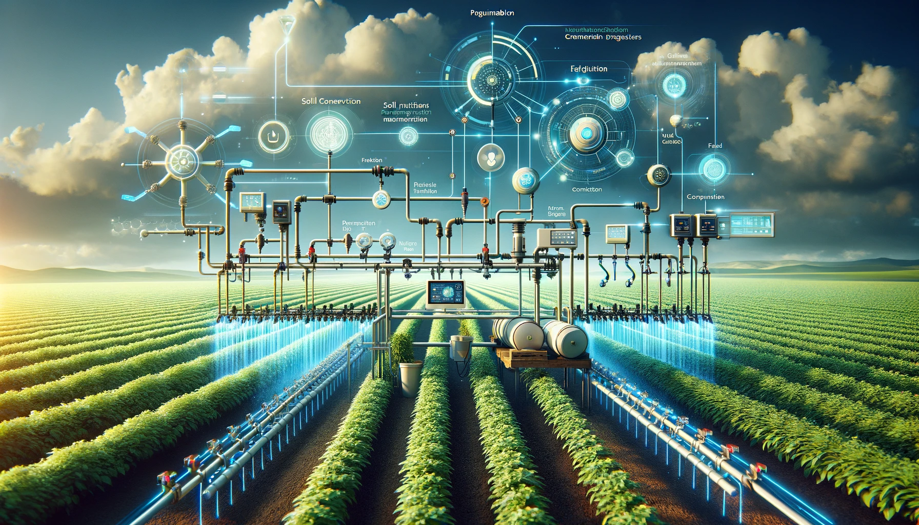
The high-precision integrated water and fertilizer system can automatically detect, allocate, and supply water and fertilizer according to different crop water and fertilizer requirements, soil nutrient content, and environmental conditions. It can perform timed and quantitative control on irrigation and fertilization, improving irrigation water use efficiency. It helps to save water, fertilizer, and electricity, reduce labor input, and lower the rates of over spraying and leakage. This system has two types: walking irrigation and drip irrigation.
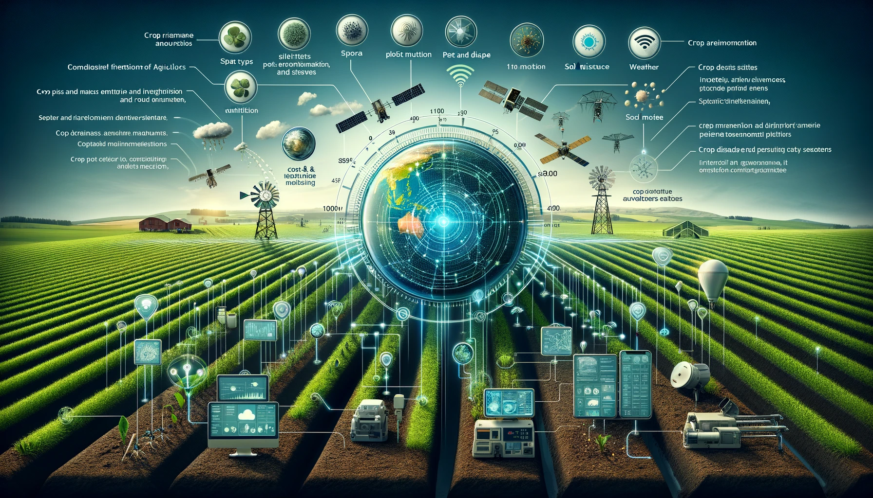
Based on space remote sensing and ground-based agricultural IoT sensors, such as soil moisture meters, spore traps, pest and disease reporting devices, meteorological stations, and spatiotemporal cameras, we can obtain data at various scales, including crop types and planting areas, crop growth, plot nutrition, soil moisture, pest and meteorological disaster warning, control and re inspection, crop disaster area statistics, insurance claims, etc. These data can guide users in scientific planting.
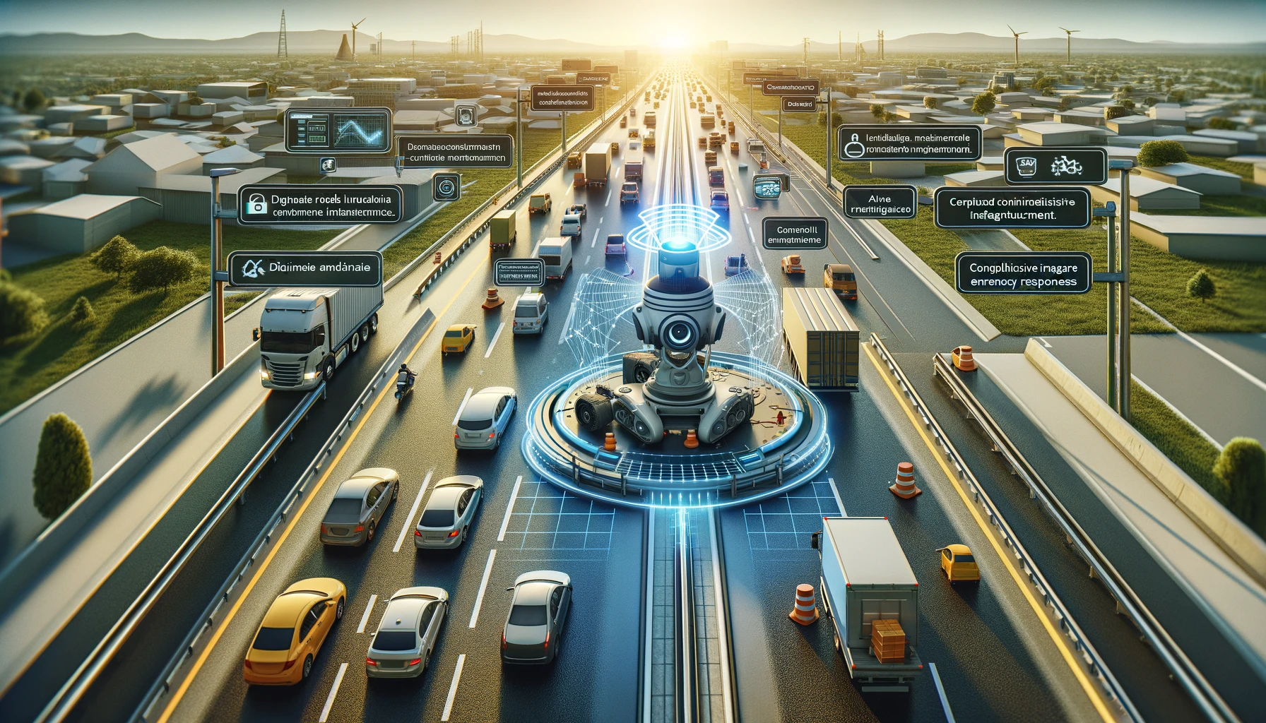
The system automatically recognizes and records information such as road surfaces, guardrails, facilities, vehicles, signs, road property, and rights. It accurately identifies and evaluates road property facilities and pavement diseases, with lane level accurate location markings, and establishes a full lifecycle image record of the road. This has achieved digitization of smart highway infrastructure, visualization of traffic operation environment, intelligence of maintenance and management, and coordination of emergency command, providing decision support for road network planning, road patrol planning, maintenance planning, and management.
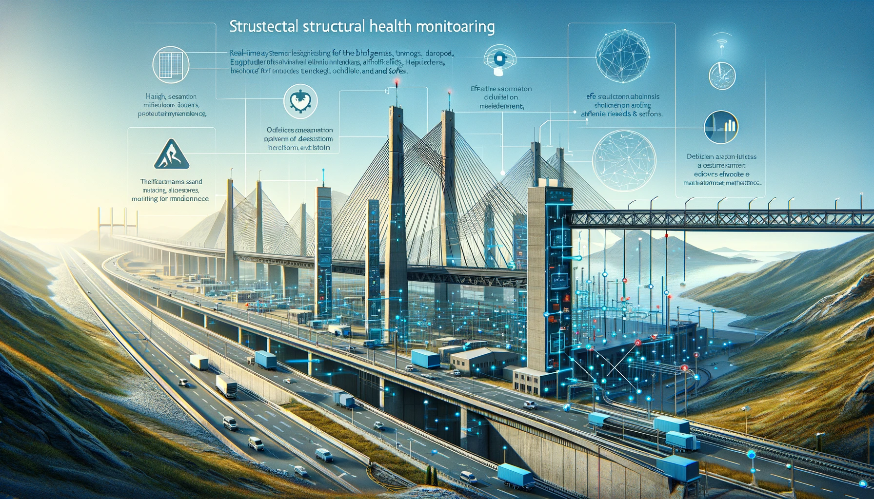
This system establishes a health monitoring system for structures such as bridges, tunnels, and slopes, and is equipped with weight, strain, displacement, vibration, crack, and temperature sensing systems. This allows for real-time evaluation of the status and security of the structure, implementing effective preventive maintenance. At the same time, it provides a scientific basis for decision-making on maintenance needs and measures.
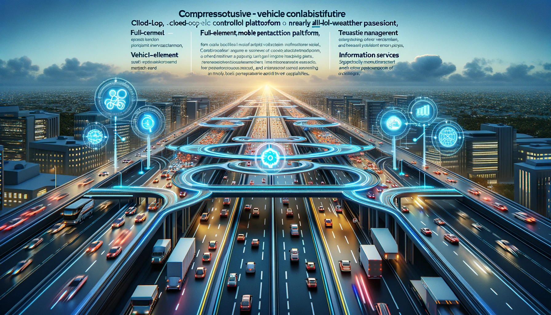
We provide a smart highway vehicle road collaborative cloud control platform, lane level mobile interaction platform (APP), supporting information services, active management, and quasi all-weather traffic applications. These form a complete closed loop from cloud to end, providing all element, all-weather perception and control capabilities. This optimizes the safety and efficiency of vehicles on highways, thereby enhancing the travel experience on smart highways.

Geofencing of key areas at different levels: This feature allows for the establishment of virtual boundaries for key areas at different levels. It manages the number of personnel, vehicles, and vessels allowed to enter, leave, or stay in these designated areas, thereby implementing strict safety measures and maintaining order.