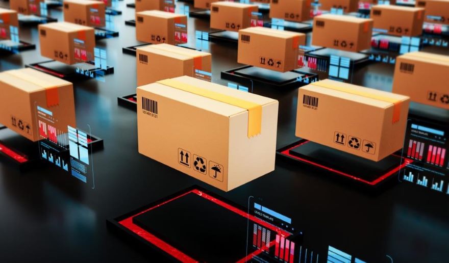
In the manufacturing industry, Beidou Satellite PNT services are mainly focused on logistics dispatch, warehousing services, asset management, security monitoring, and autonomous driving. These applications aim to enhance supply chain efficiency, reduce inventory costs, and achieve maximum asset value. Mainly applications as follows:
• Logistics Dispatch The Beidou Satellite PNT service can track and monitor the real-time location of vehicles, ships, and other transportation tools. It can also provide precise timing information to ensure the accuracy of logistics information. This helps to optimize routes, reduce transportation costs, and improve logistics efficiency.
• Warehousing Services Beidou Satellite PNT can be used for warehouse layout planning and optimization, intelligent cargo positioning, and real-time inventory management. It helps to reduce inventory errors, improve warehouse utilization, and ultimately reduce warehouse operating costs.
• Asset Management With the help of Beidou Satellite PNT, the real-time position of each piece of equipment in the factory can be accurately known, and the operation status of the equipment can be monitored, which is conducive to asset tracking, usage analysis, preventive maintenance, and so on. This can prevent asset loss and prolong equipment life, thereby maximizing asset value.
• Security Monitoring Beidou Satellite PNT can provide precise location information for security monitoring systems, such as surveillance cameras and alarm systems. This can enhance the effectiveness of security measures, ensure the safety of factory property, and protect the personal safety of employees.
• Autonomous Driving In factories, Beidou Satellite PNT can be applied to automated guided vehicles (AGVs), drones, and other unmanned equipment. This can improve the accuracy of autonomous driving, enhance the efficiency of material transportation, and reduce the risk of accidents.
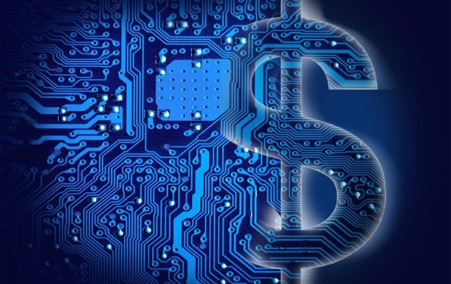
The trend of introducing satellite PNT services into the financial field has been established. Main application scenarios for satellite PNT services are currently indirect services. How to integrate the functions of satellite services with digital technology while ensuring data security and protecting user privacy, and how to apply them legally and appropriately to financial scenarios, has become a new topic in the field of financial technology.
• Local life services Refer to the use of satellite positioning and navigation functions to provide customers with location-based service support. For example, with authorized use of customer location information, help customers find nearby business outlets or financial equipment (ATMs, etc.); provide location-based scenario finance (in the context of supermarkets/hotels/entertainment/transportation, integrate credit cards, consumer loans and other financial products); send marketing or discount information based on positioning data (such as sending shopping installments, payment discounts, etc. in shopping malls); predict customers' investment and financing needs based on the frequency of their appearance in special places (such as buying cars, houses, training, medical beauty services, etc.).
• Customer analysis Refer to using satellite data to depict various characteristics of customer behavior and assets. For example, under authorized conditions, use location data to record customers' daily life trajectories, analyze customers' occupational characteristics, consumption levels, etc. In "San Nong" scenarios, use remote sensing data, high-definition satellite images to estimate the crop yield in the field, the number of livestock in the ranch, the area of mature trees in the forest, etc. In the field of clean energy, monitor the installed capacity and power generation of solar panels and wind turbines. In the field of petrochemical energy, floating-roof oil tanks are ultra-large oil storage equipment commonly used by large oil companies, and the tank roof is filled with rising and falling oil levels; the oil storage capacity of the tank can be estimated by analyzing the shadow area formed by the roof filling using satellite images, with an accuracy of 95-99%.
• Risk prevention and control Refer to the use of satellite data to monitor the operating conditions of enterprises and timely warning. For example, use satellite remote sensing imaging and big data results to judge whether the growth of crops in different stages such as seedling, jointing, and harvesting is normal. Use meteorological satellite data to predict and monitor the impact of natural disasters on crop yields. Use the remote sensing data of satellites to periodically extract and analyze satellite data for construction projects (typical examples include: changes in the construction of industrial park projects, the number of construction vehicles, etc.; changes in the number of heat collecting towers and heliostats in photovoltaic projects; the progress of dam interception in hydropower projects, construction vehicle flow, tower crane volume, etc.), to assess the actual progress and potential risks of the project.
• Supply chain finance Refer to the use of various satellites (communication, navigation, remote sensing, etc.) and Internet of Things deployed on site, combined with AI and big data processing algorithms, to collect full life cycle characteristic data of product manufacturing, quality inspection, inventory, logistics, sales, etc.; With the help of the integrated communication network of sky (satellite) and earth (ground communication), the collected data distributed around the world are recorded on the blockchain where data can be shared and cannot be tampered with. On this basis, build a supply chain ecology with the core enterprise as the main line, the use of financial communication as a booster, and the close cooperation of upstream and downstream enterprises, and integrate financial services into the commodity production, supply, and marketing scenarios of the entire chain, while improving supply chain efficiency, reduce the financial risk of banks and improve the profitability of banks.
• Industrial finance A typical example is the satellite map service industry, which is based on the global positioning and navigation functions of satellites. This function is presented to users in the form of a map that people are familiar with, and according to the usage needs of users, those businesses that are closely related to people's daily life are marked on the map, making it easy for map users to find and use the online/offline services provided by businesses. In this way, the navigation satellite operators, satellite map providers, platform operators (associating satellite maps with the location and services of businesses), online/offline businesses constitute a huge satellite map service industry. Providing financial resources for this industry (such as venture capital for start-ups, loan support for map providers and platform operators, settlement services for merchants, convenient payment methods for map users, etc.) is the function of industrial finance.
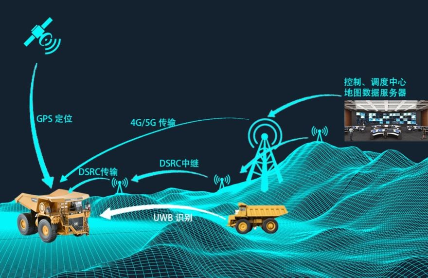
In the context of smart mining application scenarios, a fusion of technologies such as cloud computing, big data, Internet of Things (IoT), Geographic Information System (GIS), and digital twins is employed. This approach integrates information resources from mining regions, designs a unified architecture according to security, vehicles, energy, and emergency operations, and achieves comprehensive coverage, dynamic online precision supervision, and real-time sharing of information resources. Using a "single map" as a medium, the safety, environmental conditions, and energy consumption of the mining area are holistically displayed. This enhances the safety operation capacity of the mining area, promoting its benign and sustainable development. Typical case is Sany Heavy Industry.
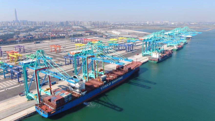
Addressing the challenges faced by traditional ports, such as lagging digitalization, high construction and operation costs, lack of effective supervision models, and prominent security issues, the Smart Port solution is developed based on spatio-temporal intelligence, autonomous driving technical experience, and the integration of cloud computing and artificial intelligence technologies. It excavates the value of large port data resources and achieves high-precision positioning of port equipment, personnel, containers, and vessels, as well as digital modeling, driving, display, and analysis of port infrastructure. This facilitates the recording and analysis of historical scenarios, real-time dynamic supervision of current scenes, and simulation optimization of operational management, ultimately realizing efficient management of Smart Ports.
The application of smart technology for water environment management facilitates three-dimensional, efficient, and intelligent inspections, forming a complete online closed-loop process from event discovery, dispatch, handling to feedback, thus realizing intelligent water environment management. Based on the Beidou high-precision positioning technology, unmanned automatic patrols and air-ground-water location linkages are implemented, enhancing the accuracy of problem localization and management efficiency. By leveraging deep learning-based visual AI technology and a recognition algorithm library for water conservancy scenarios, manpower input is significantly reduced, and inspection efficiency is greatly improved.
